Image and Data Processing
Reliable, cutting-edge image and data processing is a cornerstone of the Center for Spatial Planning Analytics and Visualization. As researchers, we take facts, figures, and photographs and mash them up to solve problems.
We are creating, implementing, and refining novel image and data processing techniques to revolutionize standards in road and transit asset management, remote sensing, and geographic information systems computing. As supercomputing and laser technology continues to advance, our scientists are excited about the possibilities of making new discoveries and creating future research approaches and solutions.
This information is valuable in areas such as the management of cities' and states' roads and bridges, including highway pavement maintenance.
The Georgia Department of Transportation uses this information to determine, among other things, budgetary needs and best techniques for roadway maintenance, including frequently applied pavement preservation techniques such as crack seal, fog seal, and chip seal.
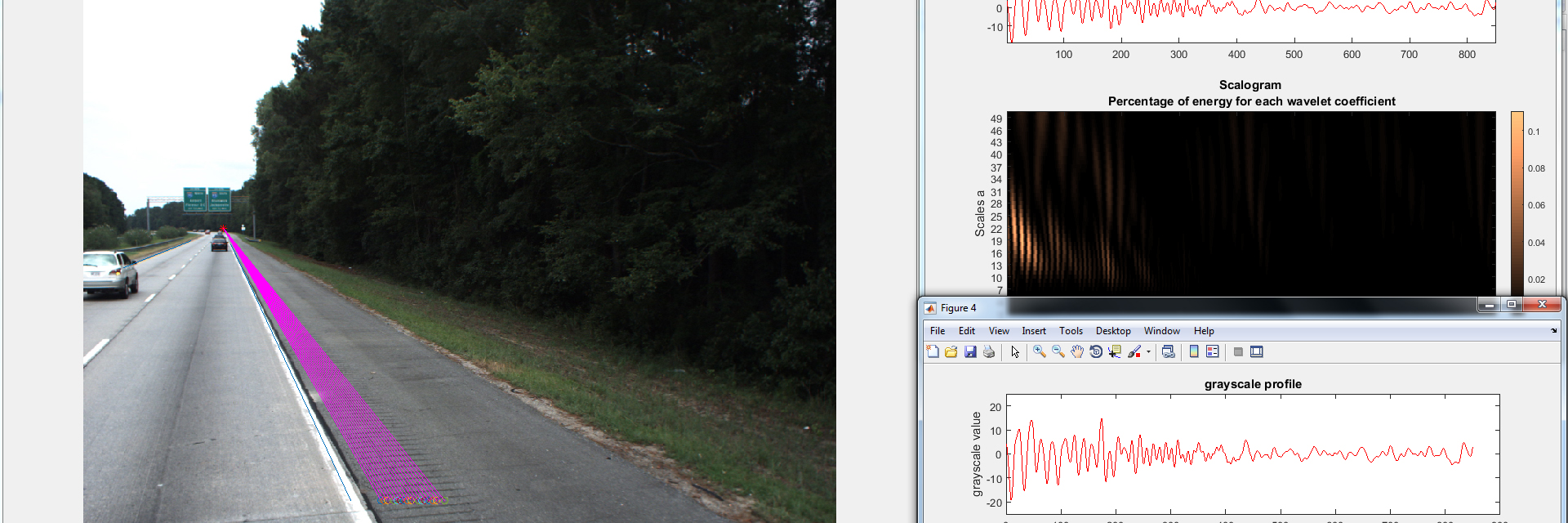
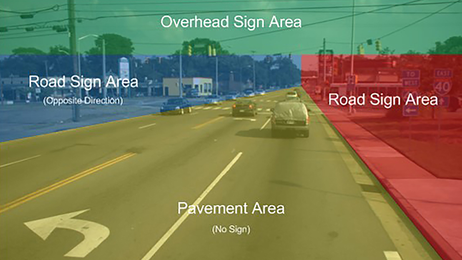
This information is also valuable in the management of roadway assets such as road signs, guardrails, and reflectors.
Managing Pavement Assets
This project developed and successfully tested a Pavement Management System for Georgia’s local transportation agencies. Because of stringent highway budgets and decaying roadway networks, local transportation agencies in counties and cities need to better manage their pavement assets, or types of road pavements, by using such a system.
However, there are still many county and city agencies that have not implemented a system because of a lack of resources and technical expertise. By carefully considering each local agency's limited resources in IT support and technical expertise, and how they deal with incompatible systems, a simple, self-contained, and easy-to-use system was developed.
Automated Roadway Data Collection
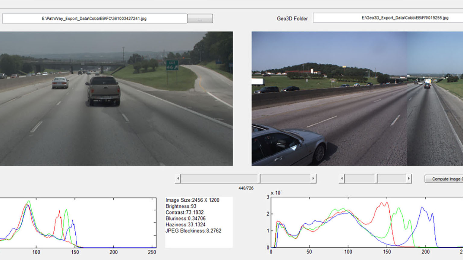
This research was designed to validate a cost-effective means to conduct sign inventory and assess visual conditions using video images. The Georgia Department of Transportation (GDOT) and other state DOTs adopted a method for conducting roadway asset inventory and pavement condition surveys using roadway video images and pavement surface imaging data to gather information on road characteristics, such as pavement rutting and cracking.