Sustainable Urbanization
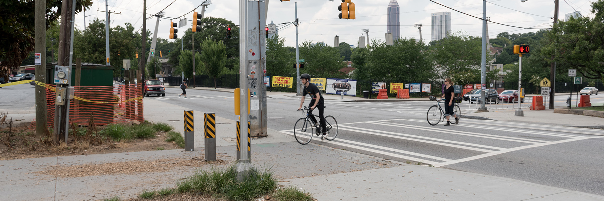
More than half the world’s population lives in urban areas, and the other half are increasingly dependent on these cities for economic and social progress. As a result, cities are at the forefront of global socioeconomic change. Overcrowding, natural hazards, deteriorating infrastructure, environmental health, and financial constraints are just some of the problems affecting cities worldwide.
City planners must look for ways to improve the lives of current residents as they work toward ensuring a viable community for future residents. Culture, recreation, transportation, education, and healthcare are part of the equation.
A sensible approach to social decision-making and urban management should emphasize efficiency in the use of resources, minimal creation of waste, long-lasting development practices, and systemic resiliency and reliability.
At the Center for Spatial Planning Analytics and Visualization, we work with various sponsors and partners to find solutions for sustainable urban centers.
Assessing Urban Tree Canopy
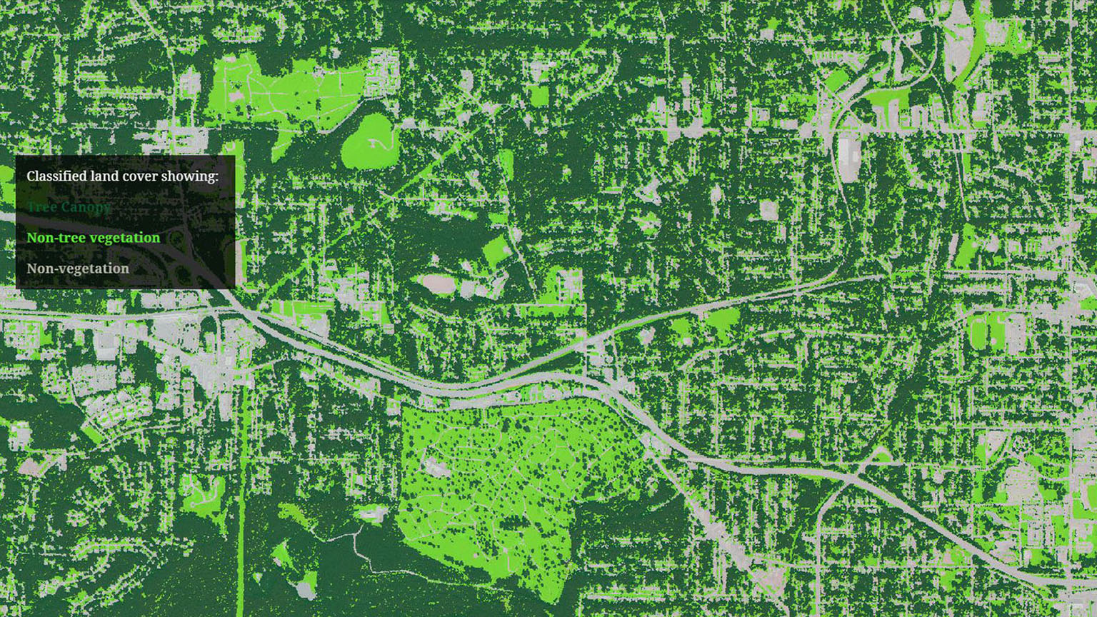
The City of Atlanta Urban Tree Canopy study was designed to help city leaders better understand and manage forest resources by quantifying Atlanta’s existing tree canopy. An urban tree canopy is defined as the layer of leaves, branches, and stems of trees that cover the ground when viewed from above. The CSPAV team estimated that in 2014, within the city limits, 47.1% of land was covered by urban tree canopy. That was down from the 47.9% in 2008.
Urban trees provide a number of environmental benefits. Among other things, they shade and cool paved surfaces and buildings, helping mitigate the “urban heat island;” they clean the air and soil, decreasing pollution; and they provide habitat for native pollinators, migrating birds, and other wildlife. Goals for this assessment included mapping the urban tree canopy and other land cover across the city, establishing a baseline for measuring change over time, and identifying potential sites for tree planting.
Walk This Way!
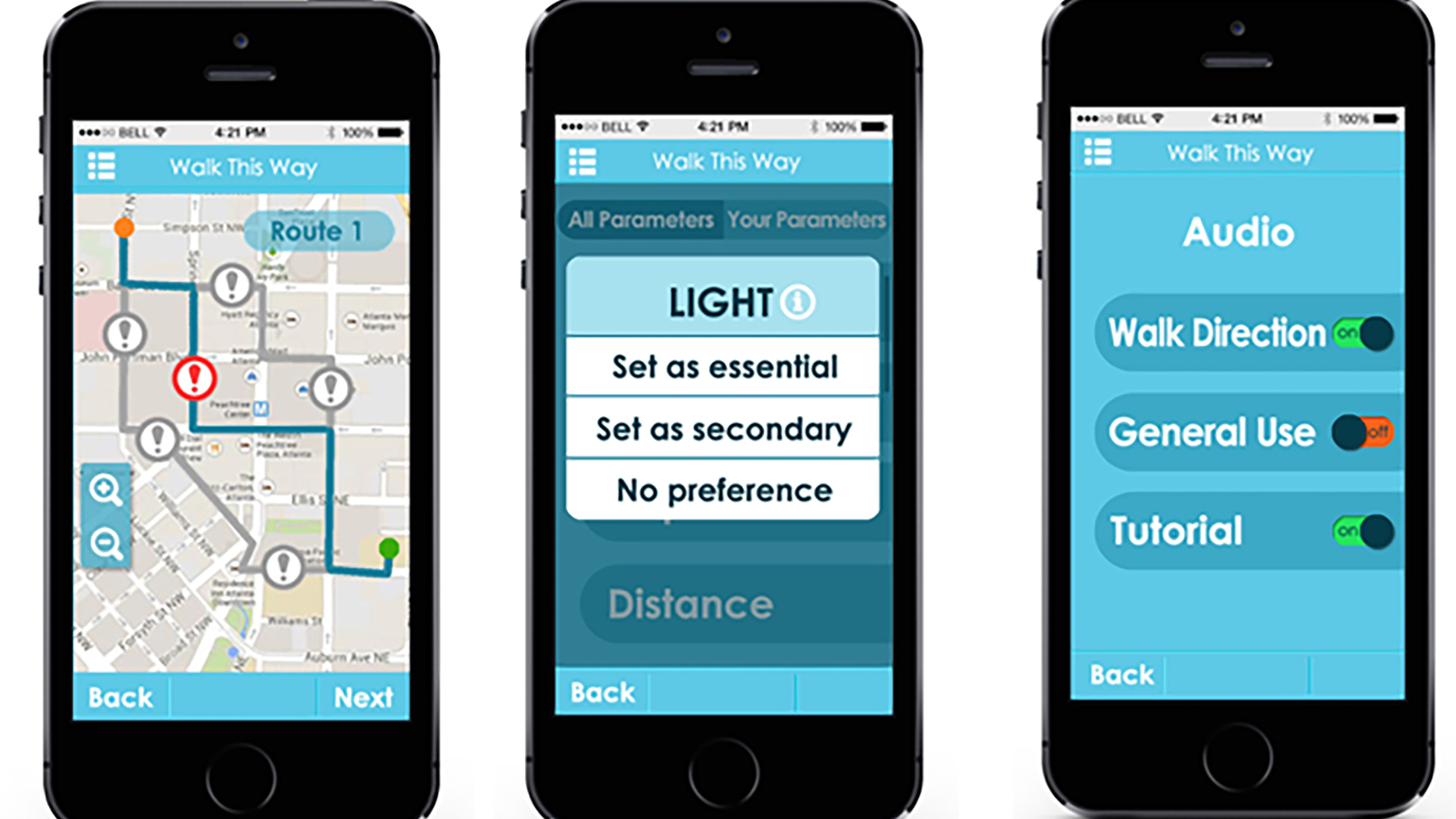
The Walk This Way! smartphone app gives users the ability to choose the best walking route according to specific choices. Sometimes the shortest route may not always be the best one if the user is interested in more than merely arriving at the destination as quickly as possible.
The app lets the user pick from 10 attributes when choosing a route: residential density, business density, land use diversity, land use accessibility, street connectivity, crime safety, traffic safety, physical barriers, aesthetics, and pedestrian infrastructure.