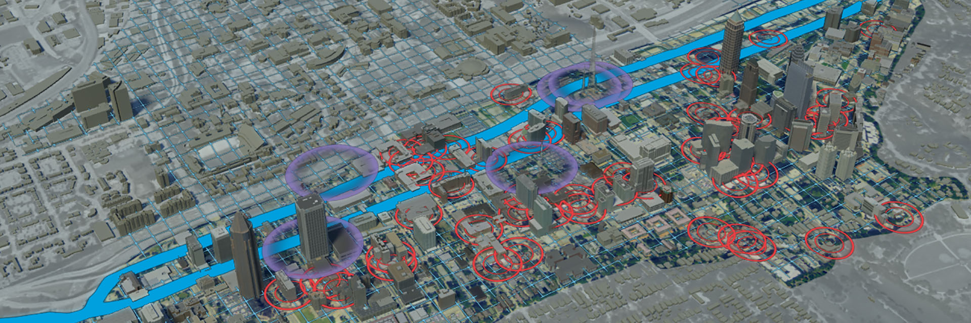
Immersive Visualization and Simulation
Researchers at the Center for Spatial Planning Analytics and Visualization develop technologies that allow people to immerse themselves physically and mentally in real world and virtual environments. These computer-generated models -- such as the 3D rendering shown above -- help us better understand our interactions with space and time, which ultimately helps inform how those connections influence the design process. They allow us access to places that we can't physically see or enter.
These technologies are used in the development of hardware sensors, interactive computer environments, software applications, physical interaction with technology, user interface design, augmented and virtual reality, 3D animations, and game engines.
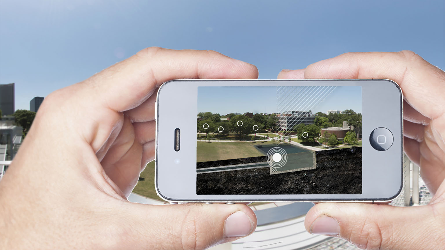
Georgia Tech Arboretum Project
The Georgia Tech campus contains hundreds of species of trees. The IMAGINE (Interactive Media Architecture Group in Education) Lab is building an augmented reality application for mobile devices and tablets that will let users view trees interactively. In the app, users can touch a tree and receive information about it such as age, size, and species. The user can also see the tree's projected growth for the next 10, 25, and 50 years, all rendered in 3D on the screen. In addition, the app allows the user to see an augmented view of the campus, enhanced with illustrative educational information.
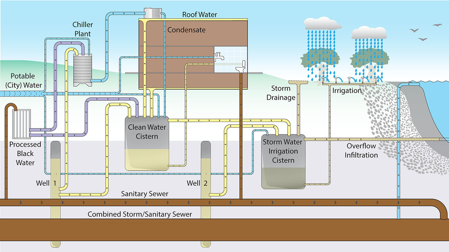
Georgia Tech Eco-Tour
Over the last decade, Georgia Tech has made significant investments in underground facilities for stormwater management. These include cisterns, wells, tanks, pumps, irrigation systems, and fountains. The goal is to prevent additional water loads from entering and contributing to the Atlanta sewer system.
While these campus systems are numerous, they are unknown and unseen. To promote these investments, the IMAGINE Lab works with Georgia Tech's Office of Capital Planning and Space Management to develop an application to visualize these underground systems. The mobile app provides general information about the systems as well as 3D navigable models of several sites, which include views of the buildings, landscape, and underground pipes. Through this application, users can learn about the parts of the system and how they work to maintain campus water consumption.